
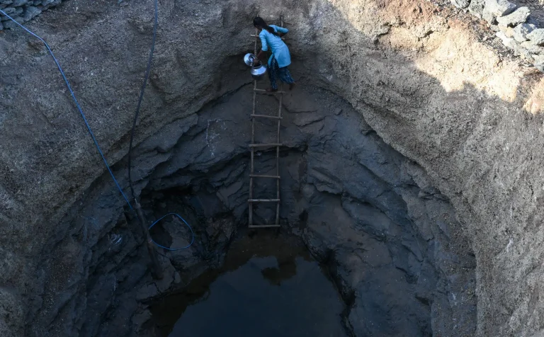
El Niño is the planet’s recurring natural agent of chaos, disrupting weather patterns, raising global temperatures and usually reaching its full strength around December.
But this year’s El Niño, which is expected to break records, is already powerful and having major impacts, raising global temperatures and causing periods of drought and crop failures on several continents.
Parts of Panama, usually one of the wettest places on Earth, have not had a major storm since the beginning of May.
The fertile highlands of Ethiopia are experiencing one of their driest summer periods in four decades.
Meanwhile, India recorded its fifth-driest June since modern rainfall records began in the country in 1901.
“This is a clear sign that the effects of El Niño are really beginning to be felt,” said Chris Funk, director of the Climate Hazards Center at the University of California, Santa Barbara, reports the New York Times.
Dr. Funk called this an “early-onset El Niño.”
These consequences on the ground reflect the scale of the changes in the Pacific Ocean, where the El Niño phenomenon develops as unusually warm waters accumulate.
These episodes occur every two to seven years and have contributed to the planet’s fluctuations for thousands of years. But this year’s is on track to be the strongest in nearly 80 years of records.
Scientists are debating whether human-caused climate change is increasing the likelihood of stronger and more frequent El Niño events.
El Niño episodes in recent decades have been comparatively powerful.
However, the variables that combine to create an El Niño are complex, and some experts argue that the recent trend may simply be a random fluctuation.
What is clear is that El Niño’s fluctuations are being compounded by stronger storms, drier periods and more intense wildfires that global warming is already bringing.
El Niño will amplify these phenomena in some regions and could push global temperatures to record levels next year, as heat from the Pacific spreads around the world.
“What we’ll see in 2027 is a preview of what the ‘new normal’ will be in 2035,” said Zeke Hausfather, a climate scientist at “Berkeley Earth,” a nonprofit research organization.
“We’ll see things that have never happened before in our history in terms of temperature, drought conditions and extreme heat”
A year of extreme heat
El Niño episodes are measured by looking at sea surface temperatures in a specific rectangular area of the Pacific Ocean. Temperatures there have risen sharply over the past three months, and forecasts suggest that, by the end of the year, they could exceed normal levels by more than they did during the most powerful El Niños in modern history, which occurred in 1982-83, 1997-98 and 2015-16.
For the period between October and December, the National Oceanic and Atmospheric Administration (NOAA) says there is an 81 percent chance that El Niño conditions will be “very strong,” meaning the three-month average temperature in that area of the Pacific will be 2 degrees Celsius (or 3.6 degrees Fahrenheit) above normal. But forecasts show that daily ocean temperatures during this period could rise to more than 3 degrees Celsius above normal.
“It might not seem like that much: three or even four degrees. We see that temperature variation within a day,” said Samantha Stevenson-Karl, an associate professor and climate modeler at the University of California, Santa Barbara. “But the ocean doesn’t change that much. Almost never.”
Excess heat in Pacific waters also affects air temperatures.
For the first months of the year, 2026 was clearly cooler than 2024, which was the hottest year on record for the planet. But Dr. Hausfather still gives 2026 a 40 percent chance of being Earth’s hottest year in recorded history, a sign of how the pendulum can swing.
According to NOAA, last month tied July 2024 as the world’s hottest July since global record-keeping began in 1850.
Acute hunger on the rise
El Niño causes major shifts in winds that carry moist air across the oceans, and impacts on agriculture that depends on rainfall are already emerging in several regions.
By the end of the year, El Niño could cause nearly 50 million more people around the globe to experience acute hunger, an increase of roughly one-fifth, according to the United Nations World Food Programme.
At the western edge of the tropical Pacific, El Niño has brought a dry summer to parts of Southeast Asia, delaying the planting of rice and other crops in Thailand, Cambodia, Vietnam and the Philippines.
In India, monsoon rains (seasonal winds that recur periodically) have intensified in some regions in recent weeks, although large areas of the country remain in a rainfall deficit.
At the other end of the Pacific, El Niño has delayed planting and damaged crop growth in Central America. Rainfall in Guatemala was as much as 85 percent below average in July, and crop stress has been compounded by temperatures significantly above normal.
In Panama, the dry spell has raised concerns about operations at the Panama Canal. During the last El Niño, in 2023-24, a severe rainfall deficit snarled traffic on this waterway, which raises and lowers ships through locks using water from a rain-fed lake.
As El Niño has grown stronger, the Panama Canal Authority has tightened restrictions on how heavily ships can be loaded while transiting the canal.
Officials have not ruled out limiting daily crossings, according to a statement last week from Octavio Colindres, a spokesperson for the canal authority.
It is difficult to predict how far below normal rainfall will be in Central America in the coming months, said Steven Paton, who monitors the oceans and atmosphere at the Smithsonian Tropical Research Institute in Panama.
The reason, he said, is that scientists’ computer models are based on past events. This year’s El Niño is expected to be so much stronger than any previously recorded episode that we cannot be sure how accurately the models will predict its impacts.
“At best, it will be as bad as the worst we’ve seen before, and possibly much worse,” Paton said.
In East Africa, El Niño usually brings heavy rains, and even floods and landslides, from November to January.
But when the phenomenon appears earlier in the year, it can suppress rainfall in parts of the region, including western Kenya and Ethiopia.

This has been the harsh reality over the past few months, said Chris Shitote, a field scientist based in Nairobi, Kenya, for the Famine Early Warning Systems Network (FEWS NET), an agency under the U.S. State Department.
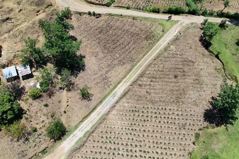
Shitote and several colleagues recently traveled through Kenya’s western grain-producing counties. The corn harvest was shockingly poor, he said.
“It’s something some of us haven’t seen in perhaps the 10 years we’ve been out in the field.”
Plants that typically grow to nine feet (about 2.7 meters) tall stopped at just five or six feet (1.5–1.8 meters), Shitote said.
A typical harvest can produce 20 to 30 bags of corn for every acre of land, growers told him. This year, it looks like there may be only one or two bags per acre.